ID 425829 | MPN FD RSVLT
Fish N Map
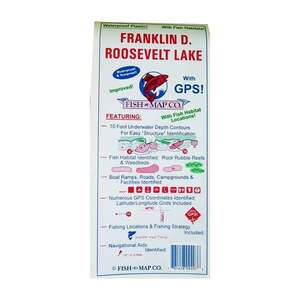
Fish-n-Map Company Franklin D. Roosevelt Lake Map


Save up to $50 on your online order today!
Advertised prices may display strikethrough or regular pricing. Strikethrough pricing on sale items represents: 1) the manufacturer’s Minimum Advertised Price (MAP), 2) the Manufacturer’s Suggested Retail Price (MSRP), or 3) a price at which the product was offered within the last 90 days.
Strikethrough pricing on clearance products represents the last regular price the product was offered at before being classified as clearance (not intended to return to our product portfolio in the foreseeable future). A discounted price will remain on clearance products until the product is sold out or otherwise liquidated.
Strikethrough pricing on clearance products represents the last regular price the product was offered at before being classified as clearance (not intended to return to our product portfolio in the foreseeable future). A discounted price will remain on clearance products until the product is sold out or otherwise liquidated.
425829
Overview
Fish-n-Map Co. Franklin D. Roosevelt Lake Map
- Numerous suggested fishing locations shown throughout map
- Fish Habitat Locations Identified
- Latitude and longitude grids with over 80 GPS coordinates identified
- Fish Habitat descriptors identified (Rock Rubble Reefs, fair and good, underwater river channels, railroad racks, shoals, point bars, humps.
- Underwater bottom conditions identified (Sand, Rocky, Mud)
- GPS Quick Scaler
- 10ft Underwater depth contours
- Boat ramps, roads, facilities shown
- Fishing Strategy
- Map is scaled using NAD 83 for the datum
- Waterproof
- Tear-resistant
- Made in U.S.A.
Scale 1:60,600 / 1:90,000 Spokane River Arm
Folds to 9in X 4in, Unfolds to 3ft X 2ft
Double-sided map
Water Type: Fresh
Region/State/s: Washington
Specifications
| Model | 865 |
|---|---|
| Dimensions | Folds to 9in X 4in, Unfolds to 3ft X 2ft |
| Material | Plastic |
| Type | Map |
| Waterproof | Yes |
| Made in the USA | Yes |
|---|
Reviews
Notify Me When In Stock
You are tracking this product.
You have removed this product alert
Thank You,
An error occurred processing your request. Please try again later.
Please enter a valid email


CUSTOMER GALLERY